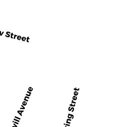
13 SHERMAN PL
Owner Information
MANEKAS JONAS
13 SHERMAN PL
MEDFORD, MA 02155


Property Details
13 SHERMAN PL is classified as a Single Family Residential (Convent/conver).
The primary structure on this property was built in 1890. There are 3,569ft2 of built area within this property. There is 1,645ft2 of residential/living space within this property. This property is listed as having 8 rooms.
13 SHERMAN PL is valued at $513,300. The land is valued at $342,900 and the structures are valued at $170,400.
This property is in Zone GR. Confirm with local Zoning Board authorities to ensure there are no overlays or other easements on this property.
The most recent deed for 13 SHERMAN PL is recorded at the local registrar in Book 50496, Page 0278. 13 SHERMAN PL was last sold on Thursday, December 20, 2007 for $290,000.
Assessment data from fiscal year 2020.
Flood Data
According to the FEMA National Flood Hazard Layer, this property does not appear to be in a flood zone. It may also be in an area not yet reviewed. Nonetheless, confirm this information prior to taking any action.
To view the flood hazards around this property, create a FEMA "Firmette" Map of the area around 13 SHERMAN PL.
Broadband Internet Providers
| Provider | Type | Bandwidth (mbps) | |
|---|---|---|---|
| VSAT Systems, LLC. | Satellite | 2 | 1 |
| T-Mobile | Fixed Wireless | 25 | 3 |
| netBlazr Inc | Fixed Wireless | 50 | 50 |
| MCI | Copper Wire | 0 | 0 |
| Starry, Inc. | Fixed Wireless | 200 | 200 |
| Comcast | Cable | 1000 | 35 |
| Verizon New England Inc. | Fiber | 940 | 880 |
| Verizon New England Inc. | DSL | 10 | 1 |
| Viasat Inc | Satellite | 100 | 3 |
| GCI Communication Corp. | Satellite | 0 | 0 |
| HughesNet | Satellite | 25 | 3 |
Broadband service provider data from December 2020.
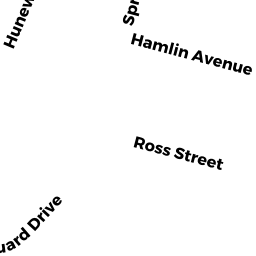
Adjacent Properties
- 8 HAMLIN AV
Single Family Residential owned by TOM DEXTER S - 18 HAMLIN AV
Single Family Residential owned by LY SONG PENG - 5 SHERMAN PL
Single Family Residential owned by SHERMAN PLACE IRR TRUST - 24 HAMLIN AV
Single Family Residential owned by LESTER ROBERT B JR - 17 SHERMAN PL
Single Family Residential owned by ANDRADE OZILENE M